Land Loss on the Louisiana Coast

 
Land_loss_in_coastal_Louisiana_since_1932_NOAA2013.jpg

The Situation on the Ground

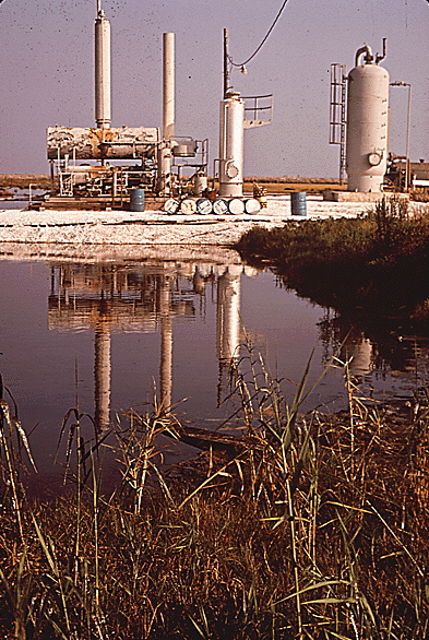
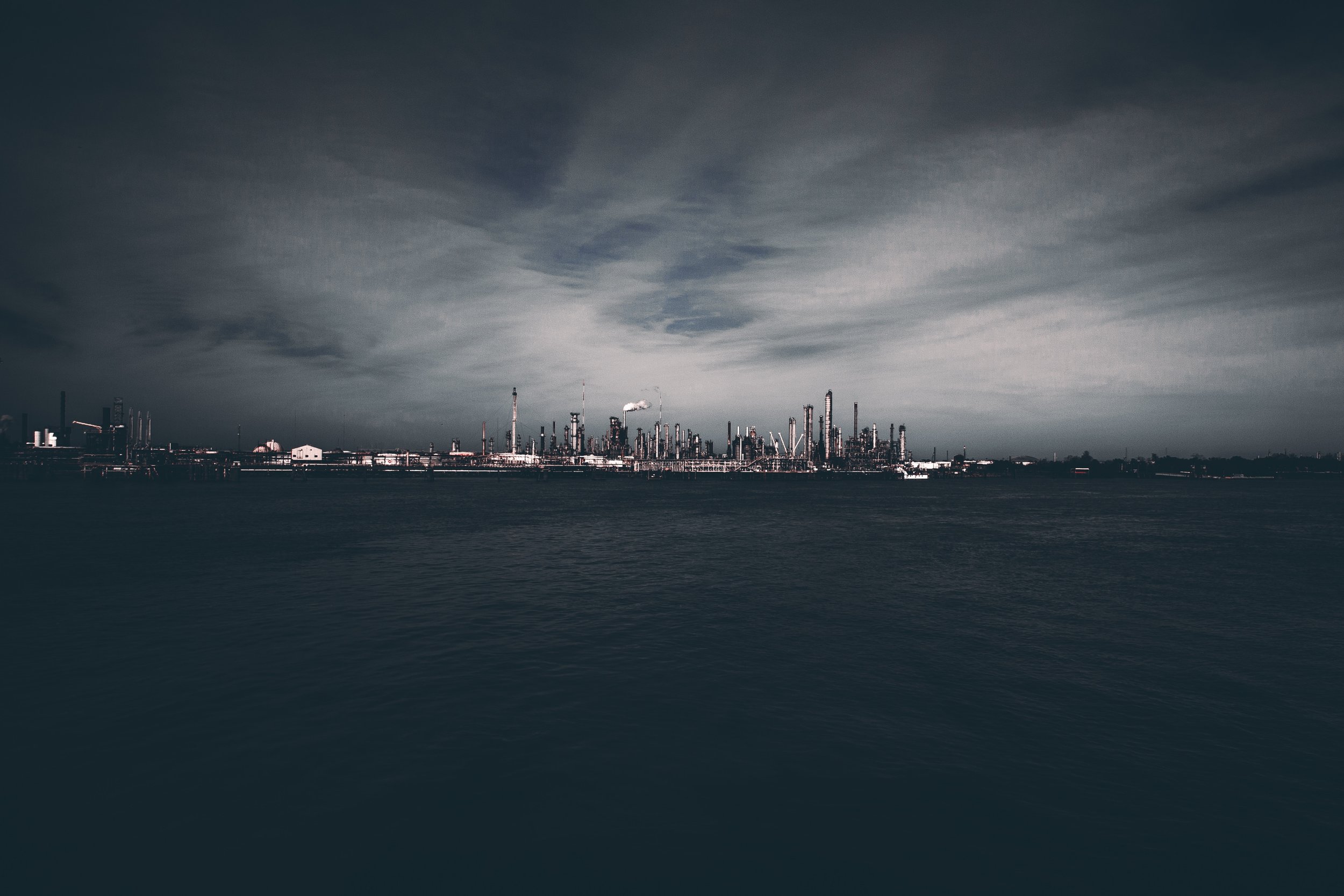
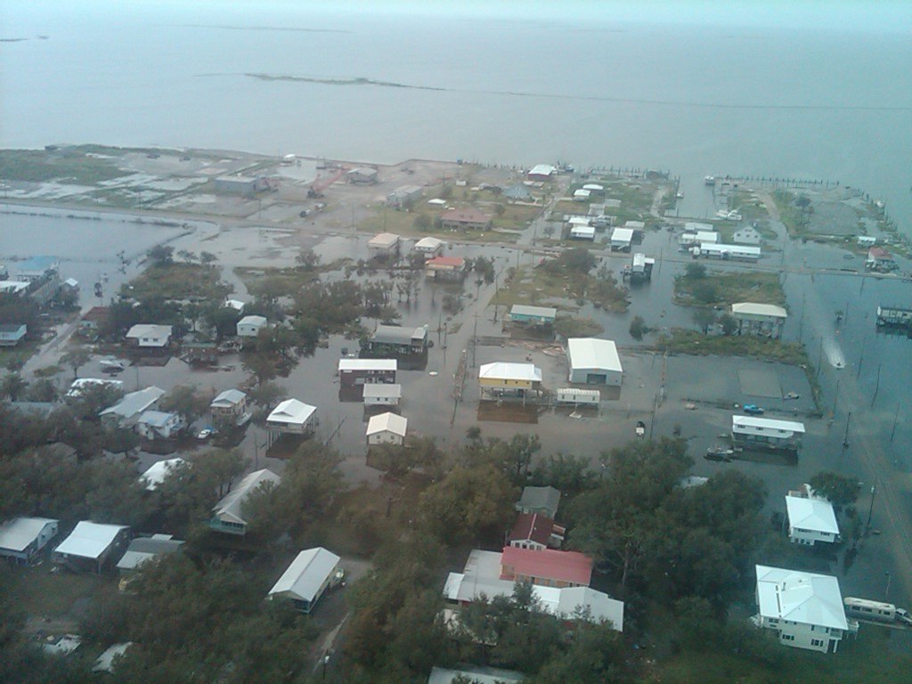
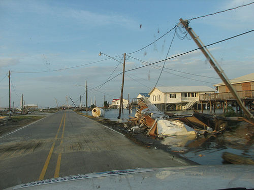
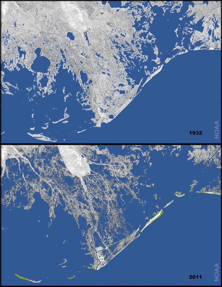
Across coastal Louisiana, the Gulf of Mexico has swallowed hundreds of thousands of acres of land in the last century.  
In Terrebonne Parish, more than 192,700 acres were lost from 1932 to 2010.  According to Louisiana’s Coastal Master Plan, if we do nothing more than we have done to date, our expected annual damages from flooding by 2061 would be almost ten times greater than they are today, from a coast-wide total of approximately $2.4 billion to $23.4 billion. 

Louisiana’s current coastal threats are shared with growing numbers of similar  communities across the United States.  These include the Miami metropolitan area, the Norfolk, Virginia area, and parts of Washington State and Alaska.

A newly released Scientific American documentary highlights the effects of Louisiana’s land loss on the Biloxi-Chitimacha-Choctaw tribe. The documentary features our very own Board President Theresa Dardar, and her husband, Donald.

Energy: Past & Future

The activities of the oil and gas industry have polluted the gulf waters, threatened local food-ways and livelihoods, and exacerbated land loss.

The Deepwater Horizon Oil Spill

On April 20, 2010 the Macondo wellhead, operated by British Petroleum (BP), began an uncontrolled blowout. Over the course of the next 87 days it spewed 4.9 million barrels (estimated by the US government) of crude oil.  The impact of this spill is immense and multi-faceted. The death of oil covered marsh grasses leaves bare land vulnerable to erosion. While the detrimental impact of the spill on commercial fisheries is well documented, academic studies as well as the media often fail to account for the losses of subsistence fishers.  Subsistence fishing is common in coastal communities and its interruption is both an economic and cultural loss.

Deepwater Horizon Offshore drilling unit burning during the 2010 BP Oil Spill. Public Domain image courtesy of the United States Coast Guard.

Deepwater Horizon Offshore drilling unit burning during the 2010 BP Oil Spill. Public Domain image courtesy of the United States Coast Guard.

Learn more about coastal communities and how they were affected by the 2010 BP Oil spill in this ABC News Segment from July 13, 2010:


Continual Small Spills and Contamination

Large spills such as the Deepwater Horizon spill garner the most media attention; however, smaller spills and contamination are common and often fly under the radar. The Louisiana Bucket Brigade is working with local citizens to document contamination. They place the tools to monitor air quality in the hands of individuals and have created an interactive map of citizen reported pollution.


Liquefied Natural Gas

Liquified Natural Gas is natural gas that has undergone a cooling process in order to liquefy and reduce the volume of the substance. The main purpose of this process is to make large quantities of natural gas easier to export across longer distances, as LNG has about 600 times less volume than it does in its gaseous state and can be transported on shipping tankers rather than requiring a direct pipeline to its destination. From an economic perspective, this makes LNG ideal for the United States to export natural gas to areas in Asia, South America, and Europe; but processing LNG comes with environmental consequences, especially for the Louisiana Coastline.

Check out Sophia Mullen’s ArcGIS StoryMap to learn more about LNG in Coastal Louisiana.


Canals

Beginning in the 1930's oil and gas companies dredged canals to create cheap and easy transport for rigs and workers. By 1990 they had created upwards of 10,000 miles of canals. While the initial dredging of the canals converted as much as 16 percent of the Louisiana wetlands to open water, the indirect impact of the canals is far greater. The network of canals created by the oil and gas industry is ranked among the primary causes of coastal land loss by the United States Geological Survey.  The canals and spoil levees (mounds of displaced soil along the canal banks) impede natural waterflow and upset the delicate balance of the wetland ecosystem. Additionally, canals create straight avenues allowing surging ocean waters to bypass the winding bayous and barrel inland during severe weather.

Canals stretch in straight lines across the Barataria Basin in Louisiana, intersecting and connecting the winding natural bayous.

Canals stretch in straight lines across the Barataria Basin in Louisiana, intersecting and connecting the winding natural bayous.


Frequent Extreme Weather Events

Satellite image of hurricane Katrina approaching Louisiana. 

Satellite image of hurricane Katrina approaching Louisiana. 

The gulf coast is frequently battered by severe weather. The summer months regularly bring torrential rain, tropical storms, or hurricanes.  Storm waters wash away land and threaten people's homes.


Layering of Disasters and Decreasing Responses

History has been described as the experience of “One damn thing after another.” The experience of multiple ‘natural’ and technological disasters is experienced as “One damn disaster on top of another.” In south Louisiana and the mountains of West Virginia and Kentucky this means the layering of natural and technological disasters on top of each other making recovery and resiliency building and vulnerability reduction extremely difficult. Add the new reality of climate change and sea-level rise and the problems associated with layering are compounded, complicated and confused. 

Metaphor (the images – poetic or scientific -- we use to describe our experience of our reality) reveal, bring new insights and clarification and hide, muddy, and confuse at the same times. The metaphors of ‘place’ and ‘people-of-place’ and ‘layering’ become critical for understanding the impact of the layering of disasters on indigenous and historied people-of-place. The metaphors of ‘layering’, ‘legacies-of- atrocity’ and ‘sacrificial-zones-of-extraction’ provide new and expanded ways of conceptualizing the situations and therefore create new ways of moving forward.

Some ‘places’ become ‘sites’ of chronic misuse of place and people-of-place creating “legacies-of-atrocity" and the problems associated with "sacrificial-zones-of-extraction." The mountains of WV and KY and the wetlands of south Louisiana are areas where the metaphor of rape is used to describe the violations of both people and places. Generations of deforestation and coal and oil/gas extraction have deeply scarred the people and places in ways that cannot be restored, reclaimed or made resilient. 

These three concepts were at the heart of the presentation/conversation by Dr. Kristina Peterson (facilitator), Dr Shirley Laska and Richard Krajeski (board members) and Dr Betsy Taylor (Alliance for Social, Political, Ethical and Cultural Theory, Virginia Tech University) at the Society for Applied Anthropology held in Albuquerque, NM in April. 

This layering of disasters creates unique issues that call for new and different approaches to research, policy development, and interventions.  It was agreed by the panel and the participants in this conversation that the metaphor of layering, together with the metaphors of legacies-of-atrocity and sacrificial-zones-of-extraction can be helpful tools in describing, analyzing and developing helpful responses to the problems associated with complex, cumulative, layering disasters.